Hey everyone! We’ve had a wild week on the Appalachian Trail this week. Many of you have been asking about the trail conditions with the severe flooding in Vermont last week. While we have been rained on quite a bit this past week, the worst of the rains were finished up in Vermont before we got there. The flooding and runoff damage has been significant in areas, but for the most part the trail has just been very soggy and muddy, but thankfully we have been able to avoid the worst of it. We’ve just been battling mosquitoes, some light rain, and MUD, and it has still been a blast. Here’s what’s been going on!
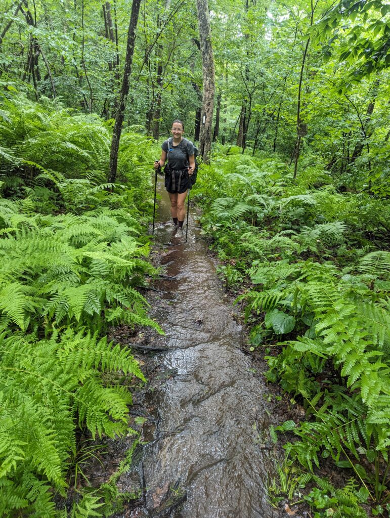
Day 113, Monday July 10: As we slept in the Tom Leonard Shelter, it poured all night. I didn’t realize how hard it was raining until the sun came up to barely illuminate the still-pounding raindrops. I woke up around 6:30am and collected our bear bags from the box, the two-minute roundtrip from the shelter enough to completely soak my raincoat through. The plan was to hike 21 miles to the next shelter, which was quite a distance even on a sunny day. Since the rain was supposed to slow between 8am and 9am, we decided to wait just a little longer before heading out. I made some instant coffee that tasted horrible beyond measure, but the caffeine was totally worth it. We cooked our breakfast of grits and finished packing up before heading out of the shelter around 8:30am, just as the precipitation turned from a torrential downpour to a steady rain. As soon as we left the shelter, we became immediately aware that the forest had become a different place than it was the night before. The trickling stream right next to the shelter that I had collected water from the night before was now a raging river, roaring and frothing tumultuously down the steep, bouldered valley. There was no way to cross it while keeping feet dry, so I used my trekking poles to poke around in the water to find the bottom and investigate for footholds. The water was only about one foot deep and eight feet wide, but was rushing so quickly that as soon as anything touched the water–such as a trekking pole or foot–it was in danger of being pulled downstream faster than the owner could utter a profanity. We crossed the stream carefully, and headed up the other side of the valley. The Trail itself was flowing, water overflowing from other streams gushing down the trail in large rivulets. There was mud and debris everywhere, and it became abundantly clear that we would have wet feet for a very long time. We crossed over twelve streams during the day that were swollen and moving quicky enough to be a little unnerving, but most of them were less than knee deep. One stream crossing was thigh-deep, however, and had it been any deeper I don’t think we would have even attempted to cross it. The current was undeniably strong, and it was difficult to keep footing on the smooth rocks. for all of the stream crossings, we made sure that it was actually safe to cross before heading in. There were a few stream crossing that absolutely would have been too dangerous to cross of it weren’t for the wobbly wooden bridges that miraculously survived the storms. The rain continued for most of the morning, and it seemed that the rainwater was following the AT just like we were. We didn’t bother putting our raincoats on because the rain would have soaked us through in no time anyway. At least it was warm enough so that we didn’t need them to keep us from freezing!
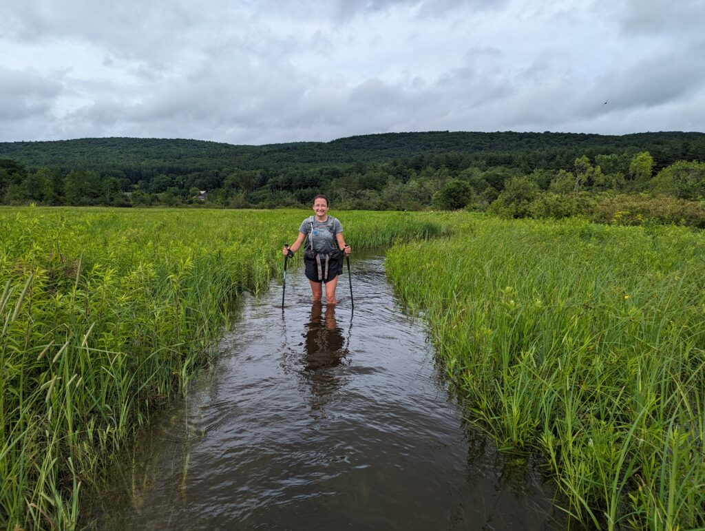
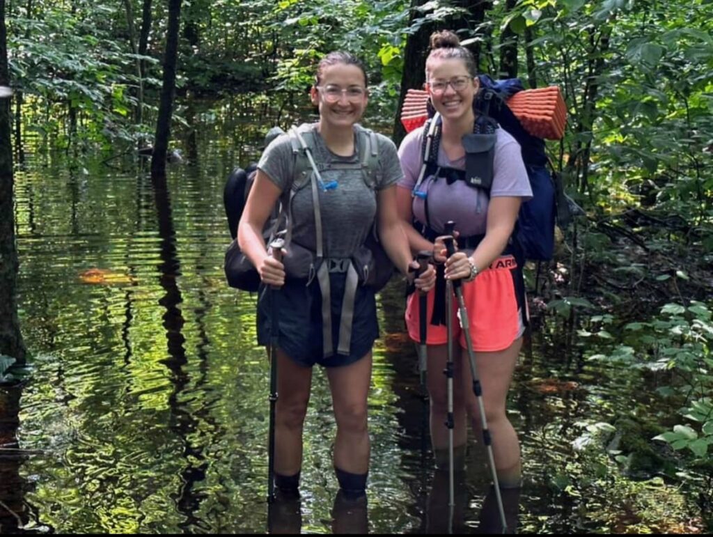
The rain stopped in the late morning, but the rainwater runoff continued running all day. In the early afternoon we came across what should have been another boardwalk through a wetland…but what we found was an open-water bog. The AT through the wetland was completely flooded, and the boardwalk planks were completely submerged. Luckily the water was flowing extremely slowly, so the only danger was of tripping and accidentally baptizing yourself and your backpack. When the water was only a foot deep or so I could see the bottom, where the now-underwater grass had been mowed recently. This section of trail definitely wasn’t supposed to be flooded! When the water was up to our knees it became impossible to see the bottom, so I used my trekking likes to leid around and make sure I wasn’t going to fall into deep water. There were a few sections of the boardwalk that had been lifted off of their anchors, and now floated up and down freely in the water. We stepped on them carefully as they sank slowly to the bottom, and when we got off of them they floated slowly back up to the surface. It took us about twenty minutes to cross the bog, and the water was cold enough to cause my feet to hurt. I joked that I could ice my Achilles tendons and hike at the same time in the bog, and why couldn’t the rest of the trail be flooded to provide this amazing benefit? The swallows and blackbirds soared all around us as we went slowly through their domain, seeming not to care that the water had risen a few feet since the day before. I was a little nervous about seeing a snapping turtle or (even worse!) a water snake, but no such monsters presented themselves. I couldn’t believe that we were still on the Appalachian Trail. Wading through the wetland was surreal, and will absolutely stand out as a highlight of hiking the trail.
We waded though ankle-deep water and mud for the entire day, finally stumbling to the end of our 21-mile day at the Goose Pond Shelter side trail off the AT. The last two miles of the day felt like an absolute marathon by themselves due to our exhausted and aching feet and knees. The side trail to the Goose Pond Cabin was a half mile long, and it too was submerged under knee-deep water in places. It was harder to see than usual since the sun was setting, so we picked our way carefully though the murky water. Finally, the shelter came into view. The shelter is more like a cabin with a full-time caretaker, but since we didn’t arrive until 8:30pm there was no more space left in the 14-person bunkhouse. The caretaker, Vlobster (yes, that’s Lobster with a ‘V’), showed us to the tent sites and let us know that he would be making pancakes and coffee the next morning for us…what?!? Vlobster said he had been a caretaker for a week at the cabin last year, and that he really enjoys it. We set up our tent and quicky cooked dinner, eating in the dark at the picnic table behind the packed cabin. Another Thru-Hiker named S’mores was also a late arrival, so he ate dinner with us as we chatted about our hikes since we had seen each other last in New Jersey. S’mores said that he was really starting to miss his family from Michigan, and that he was struggling to keep going on the AT. He said he had already gotten out of the experience what he had intended, which was to reset and re-prioritize his life, but that at this point he still wanted to finish. Meadow and I hit the tent around 9:30pm, which was a very late night for us! There were bear boxes at the cabin, which we of course appreciated. We didn’t expect it to rain overnight, but then it did…I had left my socks out but they were already soaked, so it didn’t matter too much.
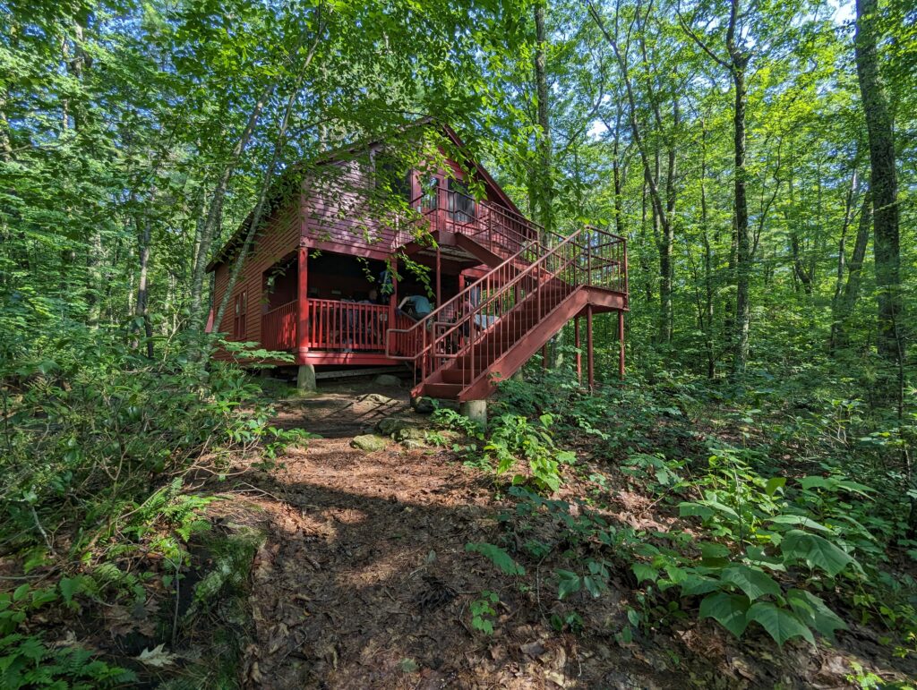
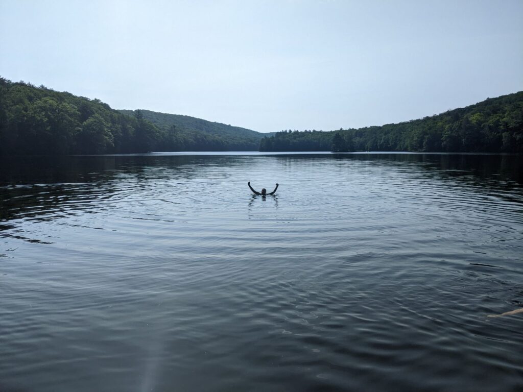
Day 114, Tuesday July 11: After hiking 21 miles the day before, it was even tougher than usual to get going the next morning. I tottered to the privy around 6:30am, and as I was headed back to the tent Vlobster called out of the cabin that it was the last call for pancakes because the kitchen would be closing in ten minutes…I guess I could move quickly after all! The straggling hikers, Meadow and I included, practically flew into the cabin to await our turn for the pancakes. Everyone got two huge chocolate chip pancakes and their choice of fake butter and/or syrup. The cabin does not have electricity, but there was a small propane stove and a propane lantern to provide some light. Vlobster wore a headlamp to see what he was doing in the kitchen. I doused my pancakes in an unholy amount of syrup before devouring them. Delicious! In exchange for the pancakes, each hiker was asked to help out with a few camp shores before heading out. I finished up washing the cooking dishes with P.F. using a series of bins of water with soap, a rinse, and a bleach disinfectant step. After Meadow and I packed up our tent and belongings, we headed to the porch to filter some water. We wanted to head down to the dock to see the pond, and Vlobster asked us to take a few empty water jugs down to the pond to fill. When we went down to the dock, most of the other hikers had already left for the day. A few stragglers, including us, were also down at the pond. S’mores was on the dock, drying out his tent and talking to his mom on the phone. Four others were having a canoe race on the pond: Renegade and Fire in one canoe, and Easy and P.F. in another. As Meadow and I filled the water jugs Renegade and Fire came in hot and parked their canoe at the dock to clinch the title. The water temperature was absolutely perfect, just a few degrees cooler than the warm morning air…on a whim, Meadow and I decided to go for a swim in the pond. The water was pretty clear and the surface was still, and the last vestiges of the early-morning mist clung to the feet of the mountains that surrounded the pond. Swimming in the pond instantly hit the top five favorite experiences of the trail so far! When I went back to the dock, as I stood on the bottom of the pond a sunfish swam up and bit me lightly on the ankle. I realized that I was standing in a little fish bed or nest (whatever you call it!). Oops! I jumped onto the dock to avoid angering the sunfish any more, and eventually we tore ourselves away from the beautiful pond.
Finally, around 9:30am, we departed the cabin. Vlobster accompanied us on the side trail up to the AT until the flooded portion so he could see how high the water still was. Although it wasn’t above our knees anymore, the water still lingered on the trail enough to submerge our shoes and socks. Vlobster snapped a photo for the Class of 2023 Facebook group!
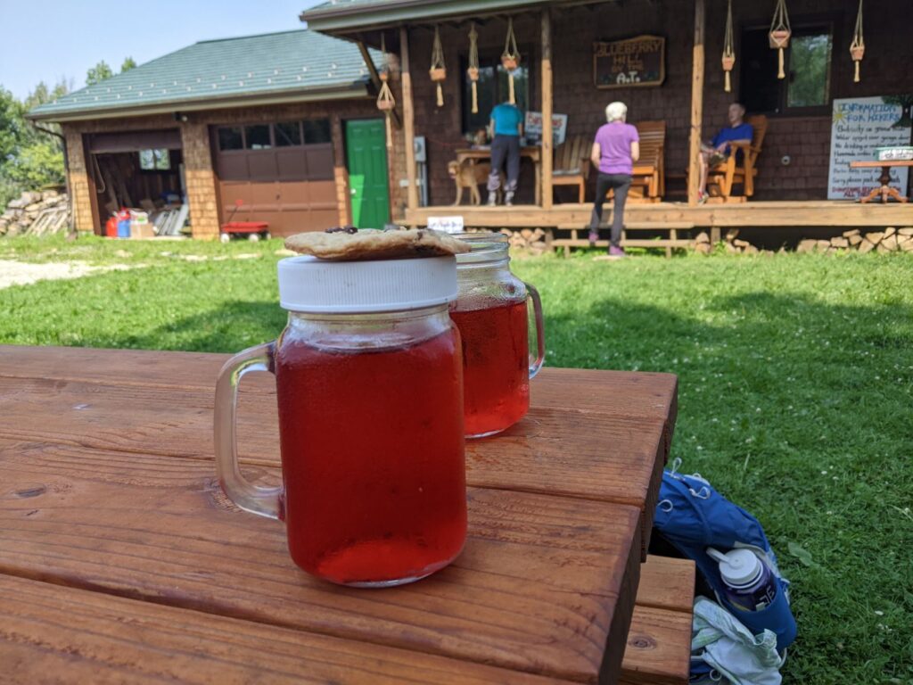
Even with our late start, our goal was to hike a normal day of around 17 miles. We hiked on all morning through more submerged trail, with water still streaming down the trail between piles of leaf and tree debris that were washed away by the floods. We crossed over I-90 as traffic flew across four lanes of highway below us, the sun still shining brightly in the sky. We hiked for over ten miles and finally reached a road crossing where a Long Distance Hiking Association (LDHA) volunteer had set up a trail magic station. He had oranges and bananas, cold water and soda, oatmeal cream pies, and what became my new favorite thing to have at trail magic: hardboiled eggs! He had full shakers of salt and pepper, which really took the protein I was looking for over the top. To be honest the eggs were a little under-done, but they were still cold from the refrigeration and they were free, so obviously I had two and said nothing about the fact they were a little runny. We chatted with the volunteer about his Thru-Hikes, and how he ranked his favorite to be the CDT, then the PCT, and then the AT. We walked up the road a short way to the Cookie Lady, a blueberry farmer who prepares homemade cookies and lemonade for hikers. We weren’t disappointed: we were able to charge our phones while drinking homemade redcurrant lemonade and eating chocolate chip cookies. We stayed for about an hour while our phones charged, enjoying the sunshine and chatting with Renegade, Fire, and their hiking comrade Kanga (short for kangaroo). After 4pm we still had over six miles to hike, but it was hard to leave the idyllic farm. Back on the trail, we ground out the last few miles and made it to Kay Woods shelter after 7:30pm. Captain Nemo and Little Fruity were there, along with the few other hikers we had hung out with at the Cookie Lady’s yard. We had the loft of the shelter all to ourselves, except for a few oversized and rather territorial moths. Exhausted, we made dinner and plopped our food in the glorious bear box and went to bed.
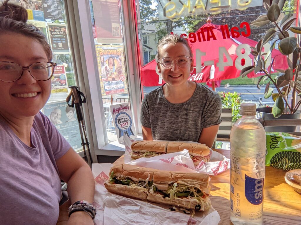
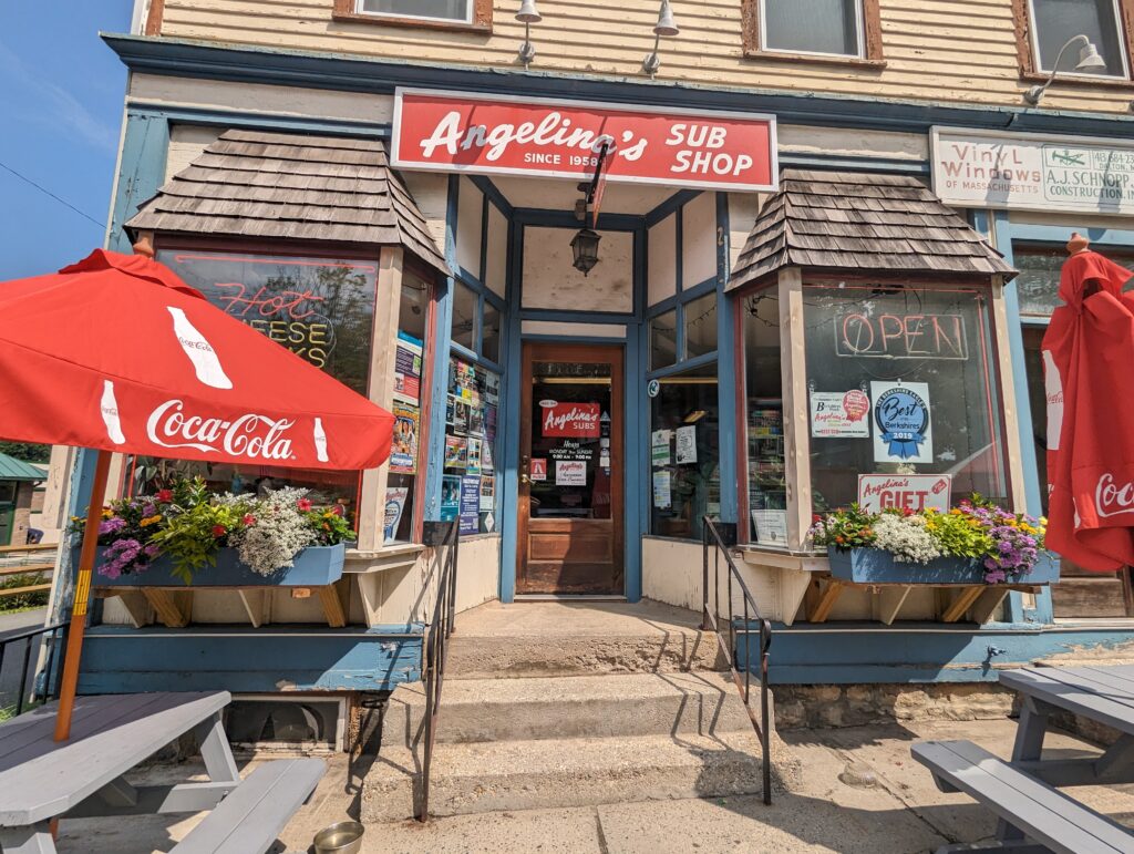
Day 115, Wednesday July 12: We woke up at Kay Woods shelter around 6:30am and got moving on the earlier side. The sky was blue and the sun was shining, which I absolutely revelled in. We hiked a paltry three miles to the little town of Dalton, which the AT passes right through. My first observation when we hit the town was the strong smell of fresh cut lumber from the hardware store on the edge of town; lumber is one of my favorite smells! We hiked about a mile into town and swung by Angelina’s Sub Shop. We arrived exactly at 9am just as the door was unlocked, and we both got footlong subs. Meadow ordered turkey and I had the Italian. We shared a huge bag of chips and I got a chocolate whoopie pie (or gob, for you non-central-Pennsylvania folks). The Angelina’s staff were very hiker-friendly, and they filled our water bottles and we were able to charge our phones. We ate half of our subs but wrapped the other halves to go, and headed back to the sunny trail.
The plan was to hike another nine miles into the town of Cheshire for resupply. We had decided to take a shorter day of twelve miles to rest and allow time for picking up some supplies. The miles passed relatively quickly, but weren’t necessarily easy. We had a few tough climbs, but we agreed that the scenery was gorgeous. The rocky coniferous forest were becoming more common, and we hiked past several large wetland ponds. We stopped for a break after a few hours to eat the rest of our subs even though we weren’t really hungry, but mostly to get the weight off of our packs and hopefully eat the mayonnaise before it went bad.
Eventually we reached Cheshire, and headed straight for the Dirty G (Dollar General) to pick up a few more days of food resupply. It started to rain on us as we approached the store, but it surprised me how little getting rained on bothered me. I had better be used to it by now! Inside we picked out some salty snacks, granola bars, some tortillas and tropical fruit for our wraps, and some more bug spray. (The mosquitoes are still unbelievably bad!). After we checked out we took our loot to the front of the store, and since it had stopped raining we sat on a few of the plastic lawn chairs for sale and sorted the goods into our food bags. Laden with heavy packs, we headed back through the town fo Cheshire to stay at the Father Tom’s Campsite right in town. The campsite is a large grassy area next to the Cheshire Highway Department building, and there were a few power outlets, a bear box, and a municipal water tap provided. Even better, there was an ice cream stand across the street! A few other hikers had also set up their tents here, including Kanga, Fire, and Renegade. We set up our tent ahead of the threatening rain, and then got some ice cream. I tried the maple walnut which was delicious. After returning to the campsite, the thunder started and fifteen minutes later we were caught in a huge thunderstorm once again. The wind seemed like it was enough to collapse the tent, and the rain wounded the tent with such force that kittle droplets made their way through the seams and dampened the inside. Just when it looked like we might be spending the night wet, the rain cleared and the storm rolled past. It rained lightly on and off throughout the night, but I mostly slept through it. At one point Meadow asked “Did you hear that? Some kind of animal was sniffing around our tent!” I hadn’t heard it, and I asked her “Did it sound like a big animal?” When she said no, I figured it probably wasn’t a bear and immediately fell back asleep.
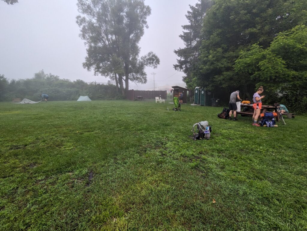
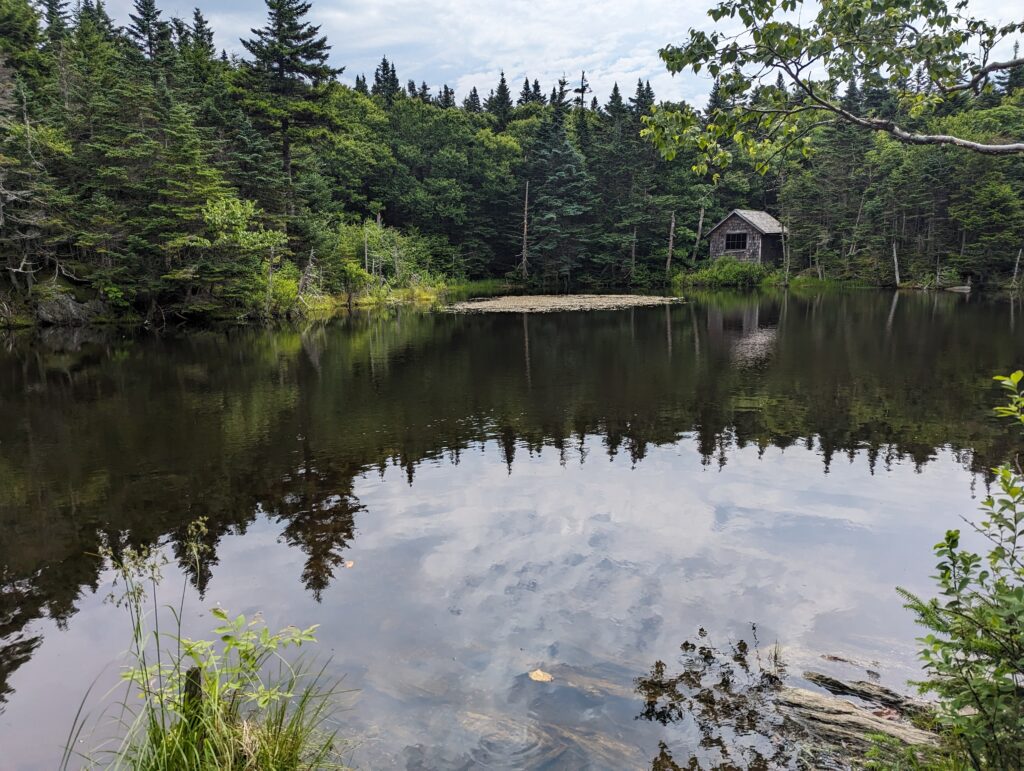
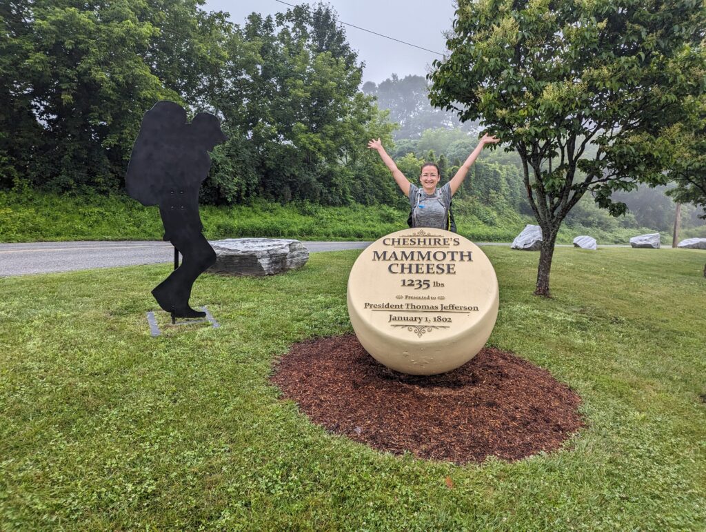
Day 116, Thursday July 13: We were trying to get in the habit of waking up earlier so we could get to camp earlier in the evenings, so we got moving around 6am. Thick fog was rolling through the campsite, but at least it wasn’t raining! We packed up the tent, still wet from the night’s rain, and ate our breakfast of peanut butter and fruit wraps. We hiked out of Cheshire, pausing to take a photo of a statue commemorating the “mammoth cheese” wheel that Cheshire gave to Thomas Jefferson. We started the day with an 8-mile climb up to Mount Greylock, which was not overly steep. We passed a few serene ponds that looked like Bob Ross paintings, one with a small shack that seemed to serve no other repurpose other than to reference Bob Ross. The trail was rocky heading up to the higher elevations, and we continued to hike through water as it streamed down the trail.
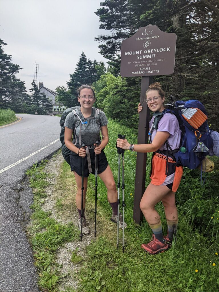
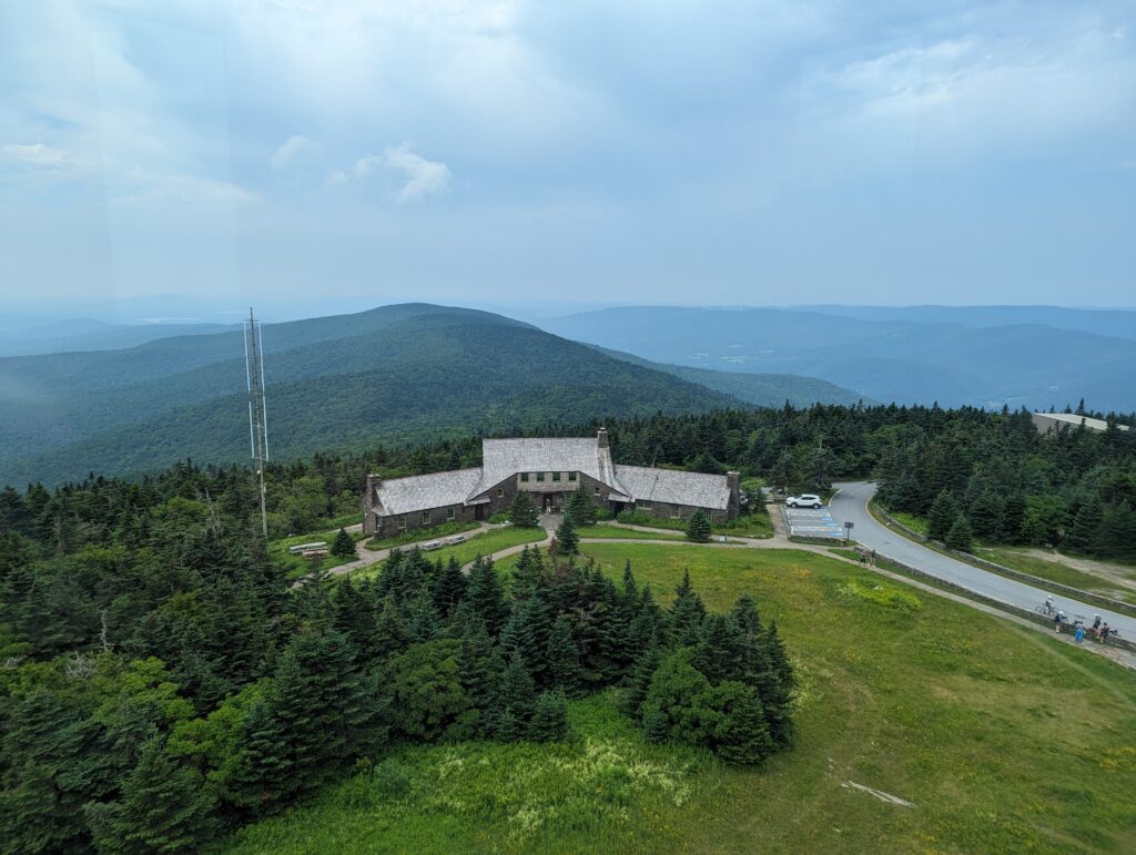
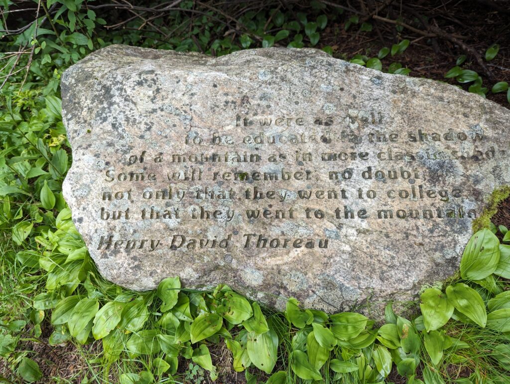
Just as we reached the Mount Greylock lodge, a woman walking up the street offered to take our photo with the summit sign. She had shoulder-length gray hair, and was all smiles. She asked us how far we were planning on going, pointing to our backpacks, and when we told her we were hiking the whole AT she exploded with joy. “Wow, that’s amazing! I’ve never met anyone before who hiked the whole thing, this is so exciting. And two ladies, too! Can I take your picture to show my daughters? They will love this!” We obliged, and she asked us a few questions. She told us we should stop in to see the Lodge before we moved on, and that the war memorial tower was interesting. “I walked up the the top with my grandson yesterday!” she told us. We did go to the war memorial tower on Mount Greylock, including hauling ourselves and our fat backpacks all the way up the 90-foot tower to peer out of the windows at the top. We also stopped by the lodge to check out their cafe prices (the ice cream was prohibitively expensive) and refill our water bottles. After eating our lunch on the war memorial patio, we returned to the Trail just as a group of bikers were walking up to the memorial. One guy in a leather vest pointed at the white AT blaze on a post by the trail, and called to his group. “See everyone? I hiked the Appalachian Trail! For all you know, I started in Georgia too!” Very funny.
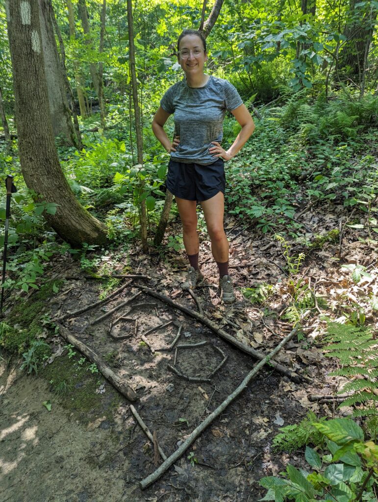
We had a long afternoon of hiking ahead of us, and the miles seemed to pass slowly. The sunshine and heat were still preferable to the rain, even though it was almost 90 degrees. We drank a lot of water, but it never seemed like enough. After all long, arduous descent, we reached a stream valley just outside the small town of Williamstown where the 1600-mile mark was waiting for us. WE HAD JUST HIKED 1600 MILES?!? These milestones never seemed to get any less exciting, or any less awesome. We only had 600 miles to go!
As we got closer to town I heard a twig snap to our left, and looked over to see what it was. It was a bear! The bear was pretty small, I would guess maybe one of last year’s cubs, and it was already running away from us. I was able to see the whole bear for a few seconds as it ran down a long downed tree before disappearing view, which was the best view of a bear I had gotten so far. We descended into Williamstown and hiked through town to find a group of coolers labelled for hikers. We found some cold water and Capri Sun drinks, and ate a few cookies and pieces of licorice while we chatted with the two other hikers that were there. Easy and Rodeo were SOBO hikers (southbounders) who had started in Maine and were headed to Georgia–our first SOBOs! They asked us how far away Cheshire was and we told them, and we asked them what the trial conditions were like in Vermont with all the rain. They said it was better than they thought it would be, not much flooding but the mud was pretty bad as always. After finishing our drinks and dumping our trash in the provided bag, we parted ways with Easy and Rodeo and wished them well. The last two miles to the campsite were hot and exhausting, but after a sixteen mile day we finally set up camp at the Sherman Brook site. The whole site was on a huge hill, but we found a flat tent spot next to a large wooden tent platform, and Kanga was also camped nearby. The campsite had a privy and bear boxes, so who cares if the whole thing is on a hill? We went to the water source nearby to collect water, which was an artesian well. The water came straight up from the ground in a sandy and gravelly pit about two feet in diameter, instead of running out of a spring in the side of the mountain. The water in the pit was about eight inches deep, and as it rose from the pit it overflowed into a little stream that then flowed down the hill. As I watched the artesian well, I could see air bubbles percolating through the gravel. Near several small holes in the pit’s base, the gravel jostled and danced slowly which was the only obvious indication that water was flowing up from the ground. It was mesmerizing to watch, and the water was cold and crystal clear. We filtered our liters of water and I filled the two-liter bladder to filter the next morning before heading back to camp. We sat with Kanga on the large wooden tent platform while we all cooked and ate dinner. Meadow and I shared our gummy worms with Kanga, and he shared with us the story of how he almost choked to death while hiking solo on the AT a few months ago before hooking up with Renegade and Fire. He said he had tried to take his miniature fish oil pill but it got stuck in his throat, and he couldn’t breathe…he started to dry heave (yes, his retelling of the story was complete with visceral sound effects) and all of a sudden the fish oil pill shot out of his mouth and went so far into the distance he never saw it again. He said he still has trouble taking the fish oil pills since he’s worried they will get stuck again. Despite the seriousness of what could have happened, Kanga’s version for the story was so funny I had tears in my eyes by the time it was over. We chatted until Fire and Renegade arrived around 7:30, just as the first thunder began to roll. We took our food to the bear box and got in the tent before 8pm. A short time later, the rain started and didn’t give up until morning. The lightning felt extremely close all around us, and the thunder seemed to rip apart the sky right above our heads. The wind and rain pelted the tent all night, but I was able to sleep for most of the night anyway.
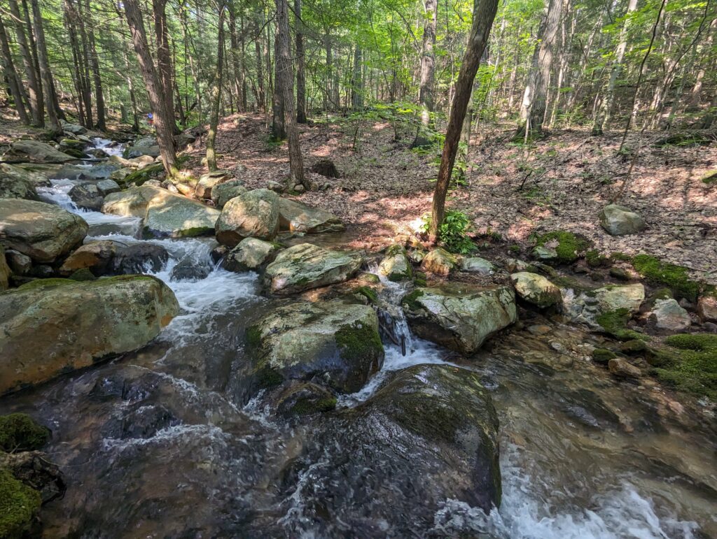
Day 117, Friday July 14: Woke up around 6:30am to a brief pause in the rain, and decided to make a break for it. We didn’t get very far, and as we were still packing up the rain started up again. We packed up the tent as quickly as we could, but since we already had a puddle inside the tent it didn’t seem to matter too much how wet the outside got! My breakfast protein bars became waterlogged even as I ate them, and the rain pounded into all of our gear the second it was exposed. We laughed about the rain and joked about how it felt SO GOOD to get soaked with a cold rain first thing in the morning. Renegade, Fire, and Kanga all stayed in their tents until after we had already left camp. We began the day’s hike with a steep and rocky ascent up to a low ridge, and after about a half an hour the downpour lessened, the rain stopped, and then all of a sudden the clouds disappeared and the sun came out. What just happened?!?
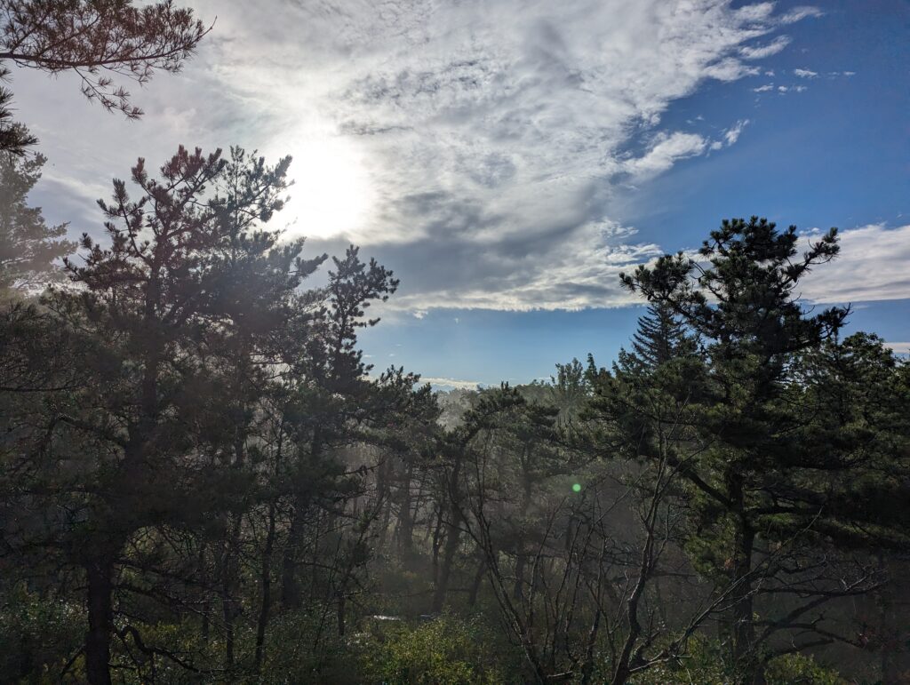
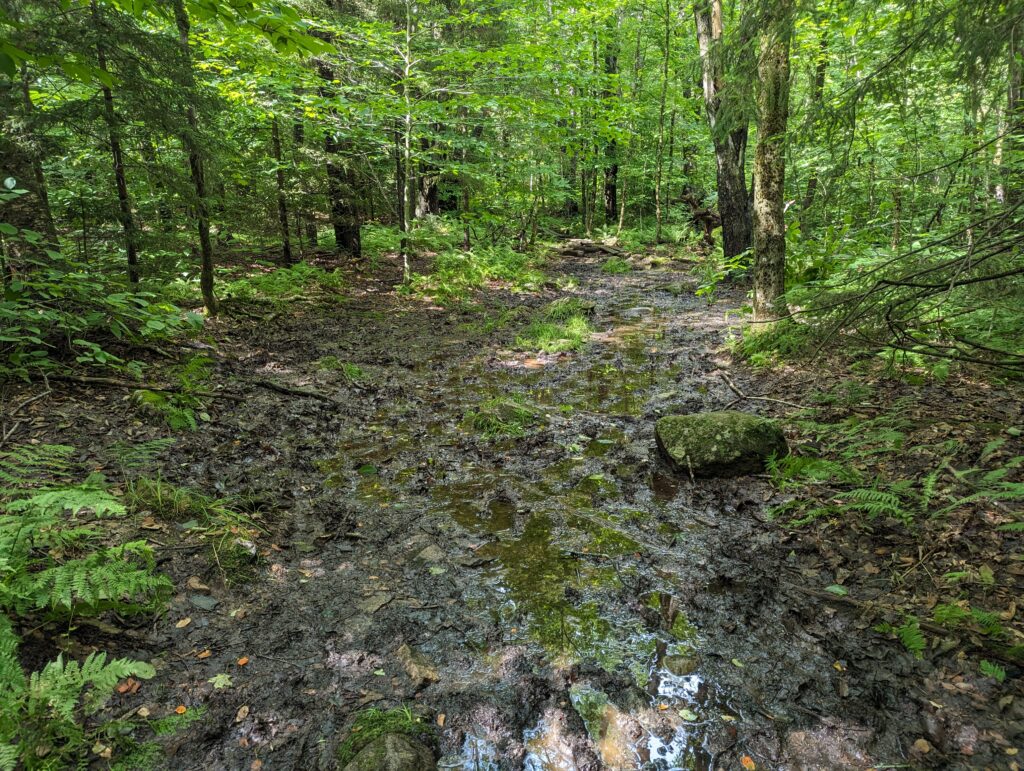
We hiked for two miles that morning until we hit the Vermont border and said goodbye to Massachusetts, which meant our eleventh state was done–only three more to go! The instant we hit Vermont, I completely understood why Thru-Hikers call it “Vermud.” The trail seemed to dissolve into the Earth, leaving massive pools of thick, gravely black mud. For the remainder of the day, we waded through ankle-deep (or deeper!) mud that threatened to suck our shoes off or hold onto our feet and cause us to fall or break a leg. Often as we prodded around a seemingly innocuous puddle with our trekking poles, the pole would sink into the mud a foot deep or even deeper causing you find another place to put your foot. Walking in the mud was more exhausting than normal trail because of its unpredictability, causing every step to be a question of “how deep is it?” or “which way will my foot slide?” The threat to rain persisted all day in the form of white and gray clouds that loomed overhead, but we did see some sun and blue skies. We hiked another sixteen miles in Vermont, but eventually we reached the Melville Nauheim shelter after a total of 18.3 miles, completely exhausted. We rinsed our socks and shoes off, my socks taking about thirty rinses before the water squeezed out of them was even remotely “not as brown as it used to be.” I hung the bear bag rope and we opened up the tent to allow it to dry off a little since it wasn’t actually raining. Our old friend Shaggy was already at the shelter; we hadn’t seen him since the Half Gallon Challenge! We cooked dinner on the most rickety and unsafe picnic table on the planet and caught up on our hikes. As we ate, Poop Spoon rolled into camp and we chatted with him too. He said he was originally from New York just north of the Bronx, and as we chatted with him he had us rolling. It was an enjoyable evening, and after spraying ourselves down with a hefty dose of bug spray we hit the sleeping bags.
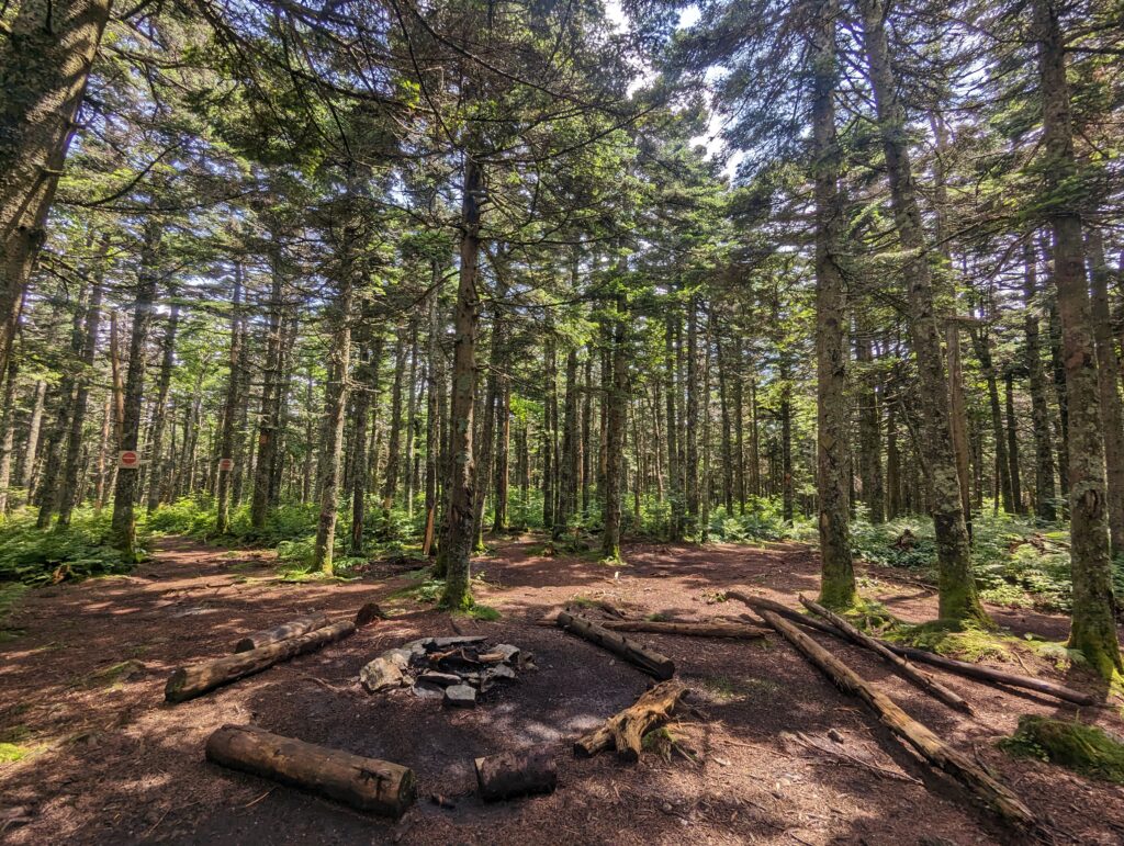
Day 118, Saturday July 15: I woke up in the shelter around 6am to a bright, sunny blue sky. We packed up camp and decided to cook oatmeal for breakfast, so we didn’t get on the Trail until about 7:30am. We started our day with a long ascent, and found ourselves huffing and puffing up the hill. The Trail was much less muddy than the previous day, but the rocks and steepness of the climb slowed us down. The forest smelled of pine, and I loved seeing the blue sky through breaks in the trees. After almost nine miles we reached the top. An old forest service fire tower had been closed off, the ladder removed to keep people from climbing up. There was a beautiful campsite at its base, with a thick blanket of rust colored pine needles and a large fire ring. A light breeze moved the pine branches around, but I could clearly hear two birds talking back and forth to each other. I ran the Sound ID function on the Merlin app, and apparently we were hearing two “yellow-rumped warblers” in the trees. Neat!
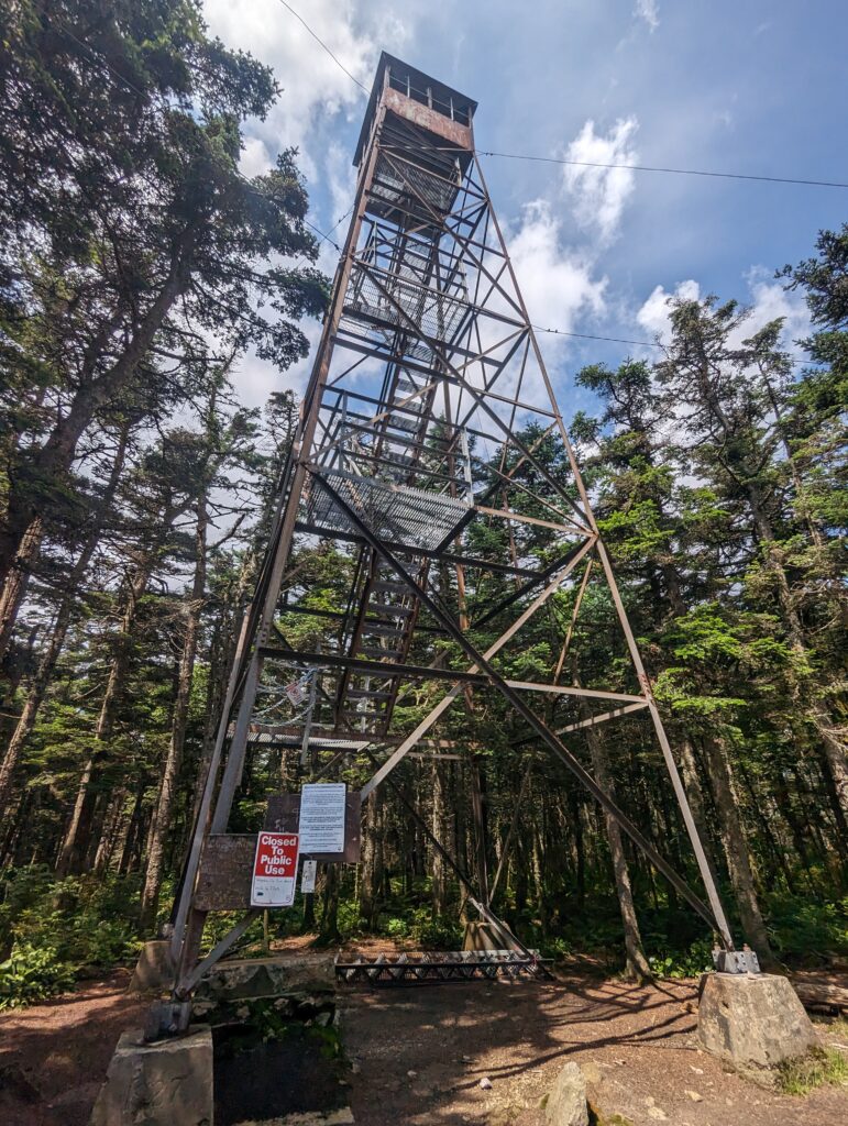
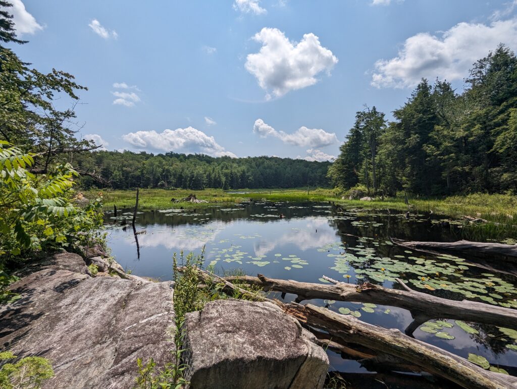
After leaving the fire tower, we had a long descent and the trail became rocky once again. Stepping from rock to rock added additional strain on the feet and knees, and by the afternoon we were feeling the burn. We had made good time in the morning, but our pace slowed in the afternoon until we were almost crawling. We made it sixteen miles to a large open beaver bog, and I scanned the water for signs of the beaver. The water was completely still, looking like a sheet of glass. A few stumps of long-dead trees stood out of the water like smooth spires, and were the only thing besides a few sparse lily pads that broke the mountains’ reflections.
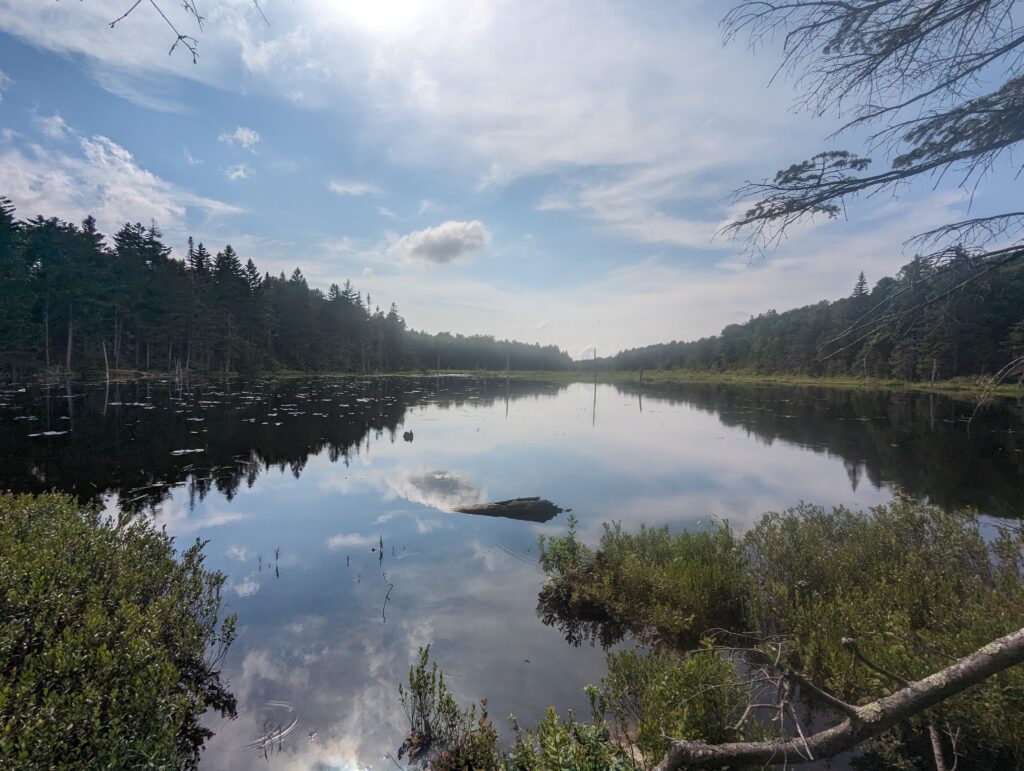
We walked around the bog for a few dozen feet, and I noticed a large pile of moose poop right by the water’s edge. We were in moose territory! I was definitely hoping to see a moose at some point during the AT hike, preferably from a safe distance. But that would have to wait, as there was no moose in sight and we still had about a mile to hike until we made it to the Story Brook Shelter for the night. The last mile was he hardest of the day so far since we were so tired and our feet and knees already exploding in pain. The trail became muddier than it had been all day, and both Meadow and I sunk in up to our ankles to finish out the day, our trail runners once again filling with pointy pieces of gravel. We climbed over six hundred feet to the shelter, and collapsed at its entrance. We dumped our packs and laughed, relieved that we were finally done for the day after over seventeen miles. We collected some water and cooked dinner, and throughout the evening we had more and more old friends join us: Shaggy, Poop Spoon, Renegade and Kanga, Mudder, Plank Fire, and PE (now named Shades after breaking his primary glasses and needing to wear his prescription sunglasses at all times) rolled in and we spent the evening chatting and catching up. Plank Fire shared his Skittles, which was a very big deal. Shades still had the tube of hydrocortisone cream that Meadow has given him several weeks before when we had last seen him for some irritation he had on his feet. He said he didn’t need it anymore and gave Meadow the tube back, thanking her. We got to see a bit of the sunset through the hazy clouds and trees, which I enjoyed even more due to the horrible rain forecasted for later that night. Sleeping bag o’clock came around 8:30pm.
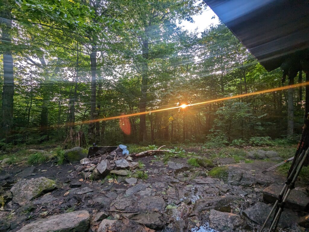
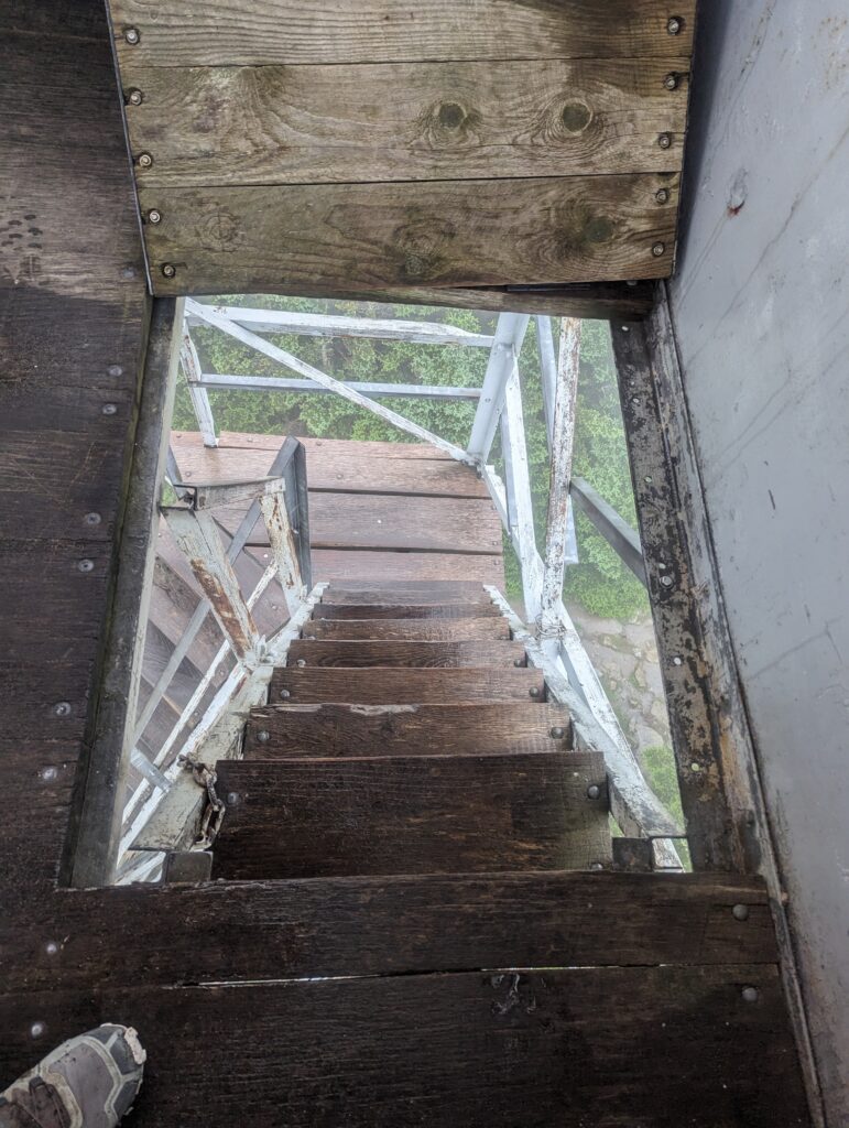
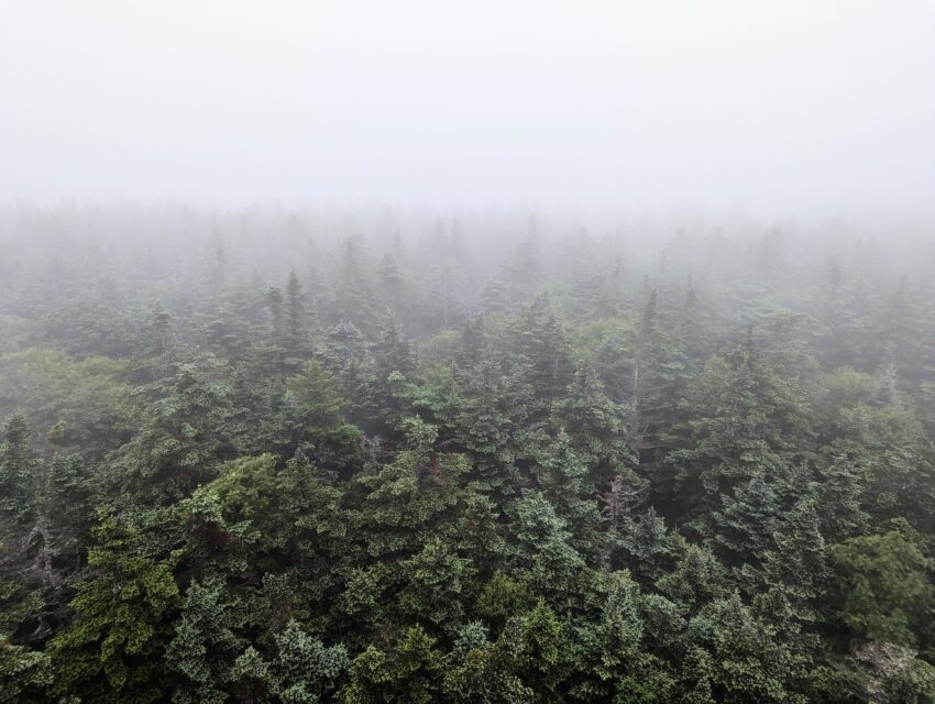
Day 119, Sunday July 16: I had set my alarm for 5:30am, but by the time it went off most of the others in the shelter and camping in the area had already left. The weather forecast predicted heavy rains starting early in the morning, and folks wanted to be on the road before it hit. We started packing our stuff up and by 6am, the rain had started and instantly revved up to a downpour. We took our time packing up and were ready to leave the shelter around 7am. We knew it was supposed to rain almost all day, so leaving the dry shelter took some effort; after a few seconds of waiting to steele ourselves, we stepped into the deluge. I was completely soaked through in less than ten minutes, the cold rain at first taking my breath away. We hiked quickly to keep our body temperatures up, and after we were warmed up to hiking speed we thankfully had no issues with feeling cold. We continued the battle with the Vermont mud and splashed through streams running down the trail. We had a four-mile ascent up to Mount Stratton, which was a 1,500-foot climb that was mostly gradual and not overly rocky. We ran into Thru-Hiker friend Shaggy at the top and we climbed up the fire lookout tower on the summit. The lookout tower was aptly named because although we could “look out” of the tower we couldn’t actually “see” anything. The thick fog shielded almost everything from view, so the tower would have been pretty useless in those conditions unless the fire was right at the base of the tower. The climb was a little scary considering how wet the wooden stairs were, but we persevered nonetheless. The sign at the bottom said that no more than four people could climb the tower at any given time…very reassuring.
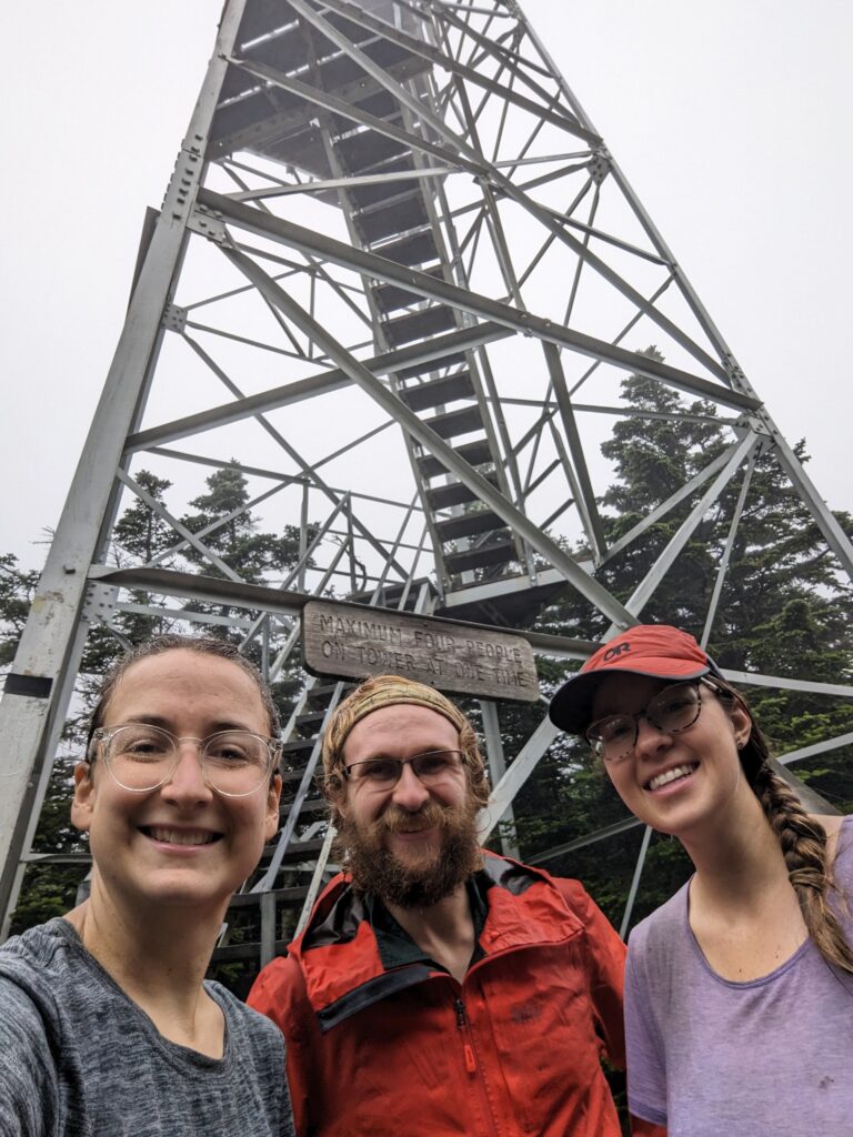
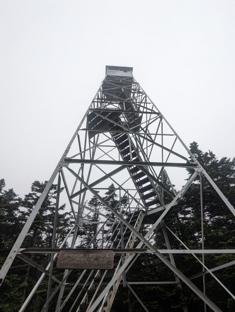
After disembarking the rickety structure, we had a four-mile descent that was also not as steep or rocky as it could have been. The pounding rain was deafening as it pelted the leaves above our heads, and we trudged on in taciturn silence. Eventually when the rain slowed we paused for a snack break, and ended up in hysterics over how bad the conditions were. Between the mud, rain, and lack of consistent trail blazing, Vermont was shaping up to be the worst state on he AT. After Meadow choked on a snack pretzel, we joked that Vermont was the Cheddar Cheese Combo cracker that was stuck in the windpipe of life. Eventually we got up and hit the trail, still laughing about the Vermont jokes. We had another seven miles to hike before the day was over, and they passed relatively quickly. During that time, we passed the 1,650 mile marker–three quarters done with the trail! Eventually the rain dwindled and then stopped altogether, and the sun even dared to come out for a few minutes. We rolled into the Spruce Peak enclosed Shelter around 4:30pm after an 18+ mile day, and for the first time in a few days we didn’t feel dead-dog tired when we stopped hiking for the day. We rinsed our destroyed shoes, socks, and legs off in the stream by the shelter and then gathered our water (upstream!) for the evening. We spent the evening sitting on the porch and cooking dinner while chatting with Shades, Plank Fire, and Shaggy. Around 8pm the boys turned in, and Meadow and I continued to sit on the porch for a while until the mosquitoes chased us inside. For the record, even though Vermont has had the worst conditions so far, we’re still loving even the hard stuff. Besides, who would even want to hike every day in beautiful sunshine instead of pouring rain and squelching mud? (Don’t answer that.)
Our big plans for next week include taking a day in town to resupply and stopping into a hostel, and making progress through Vermont. There are about 160 miles of trail through the state, and I’m keeping my fingers crossed that it doesn’t rain every day!
Thanks for stopping by!
Heather, I can hardly wait until your next blog. So proud of you both and how you take the hardships in stride. Pray for you both every day. GOD BLESS
You both are so amazing to keep such a positive attitude day after day of rain!
We’re hoping for blue skies for you in New Hampshire!
We love your blogs.
BTW we had a bridge project in Cumberland co on the AT on Saturday and north blunders are still coming thru!
Mom said you made it to the hostel. Soooo glad to hear that. Take time to dry out. Rain I could deal with… storms, they come and go… but you’ve had your share to trudge through… the streams, the mud, etc. Imagining planting my own feet, keeping my balance, and lifting my foot from a suction, like it were quicksand. All comes with the territory. And you are still smiling 😉. Awesome, just awesome. I think it’s grand. What a blessing, the new friends you both have made along the way. A bear box and covered shelter can be a tranquil haven. I think once you complete the trail, though, I see you and Nick hiking and camping a lot!!, frequent state or national parks. That would be my goal! And provide trail magic 💚
Godspeed ✌️🙏🏼
I enjoy reading all of your entries. I was really enthusiastic on the part of the Bake Oven Knob in Pennsylvania. I spent many hours on the part of the trail from there to the Town of Palmerton. I feel as though i am walking with you and loving every minute of it. Be careful and can’t wait until your next entry.
You are better than most. We would have quit before trudging through that much mud. Can’t wait for next blog.
Wow ! What an ordeal .. Rob and I have certainly been keeping you in our thoughts.. Sounds awful but glad you are OK (may take some time to dry out though!) Hoping that this week is a good bit dryer and less muddy!
Just catching up with your adventures! Reading through, it felt like I was trudging through muddy trails with you! In a sense we are since you bring everything to life in your blog.
You and Meadow are beyond amazing! Safe trekking!
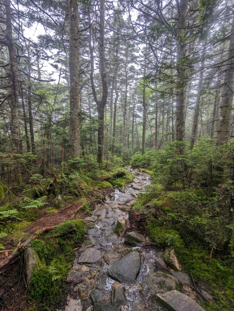
I love all your stories, but this week I am mesmerized by the green in the photo of you on the path/stream. That green is so vibrant, I can almost feel the drops falling off the leaves, the spongy ground beneath my feet! And the feel of the oxigenated air saturating my lungs.